
Sources for Edmonds Neighbors
Public records describe pieces of an Edmonds block, not a complete household roll. SCOPI supplies parcel shapes and selected property fields. The Assessor provides assessment and owner or taxpayer details. Recorded plats and deeds can explain shared boundaries. City permits document changes at addresses within city limits. VoteWA and voter extracts have a narrower civic purpose, and Neighborhood Watch adds voluntary community context without publishing a member directory.
| Official source | Block-level evidence | How to reach it |
|---|---|---|
| Snohomish County SCOPI | Parcel polygons, property address, owner, taxpayer, acreage, value, tax-code area | Free interactive viewer; county GIS help by phone or counter |
| County Assessor | Owner or taxpayer, situs, mailing address, legal description, assessment | Online property search; phone, email, or Everett customer-service counter |
| County Recording | Plats, surveys, deeds, easements, and legal descriptions | Online for most records since July 1976; microfilm and staff help for older material |
| Edmonds permits | Address-keyed plans, inspections, and dated work within city limits | Weblink street folders or a city records request |
| Neighborhood Watch | Voluntary block organization and safety planning | City community-engagement coordinator; no public membership roll |
An owner hit means the assessment system ties that person or entity to a taxable interest. It does not establish occupancy. A trust, estate, company, or representative may appear, and the tax mailing address can be outside Edmonds. Keep each label intact before drawing any conclusion about your neighbors.
Select Edmonds Neighbor Parcels
Open the Snohomish County SCOPI viewer and search the known street address or parcel number. A selected polygon can show Parcel ID, Property Address, Owner, Taxpayer, Gross Acres, Market Value, and Tax Code Area. The parcel shape matters more than the next street number because lots can be irregular, separated by rights-of-way, or oriented toward another road.
The county describes SCOPI as illustrative, not a certified title source. Its cadastral and assessment data can change, and open-data parcel products are described as updating three times weekly. Use the map to identify which lots touch, then confirm a disputed boundary through plats, surveys, deeds, or the responsible office.
Map an Edmonds Neighbor Block
The block method expands one parcel at a time. It is narrower than tracing every address on a long road, and it helps avoid false assumptions based on house-number order. Save enough detail to return to the same parcel later.
- Normalize the starting address with USPS, then determine whether it is inside Edmonds city limits.
- Locate it in SCOPI and record the parcel ID, physical address, owner or taxpayer, tax-code area, and legal description.
- Select each polygon that shares an edge or relevant frontage. Do not rely on number sequence alone.
- Open the Assessor summary for each selected parcel and keep its situs and mailing address in separate columns.
- Use a plat, survey, deed, or permit only when the block question needs that extra fact.
For the whole road rather than the immediate radius, use the Edmonds street directory and its full address-record chain. On a block search, stop once the relevant adjacent parcels have been checked.
View Edmonds Neighbor Geometry
The official SCOPI access page routes residents to the parcel map and its desktop or mobile guidance. It is the manifest's successful image assigned to neighborhood parcel work.
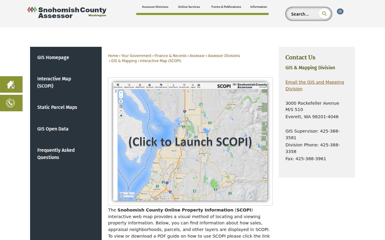
The capture marks the right starting point, while the live viewer supplies current polygons. Treat the owner field as a parcel fact, not a claim that the owner is one of the present occupants.
Read Edmonds Neighbor Fields
A few record terms prevent the most common block-search mistakes. Use the office's exact label in notes and avoid merging separate fields.
- Parcel
- A mapped unit of land with its own identifier. It may not match a mailing address one-to-one.
- Situs address
- The physical property location used for map and tax jurisdiction.
- Owner or taxpayer
- The person or entity tied to the assessed interest, not proof of a current resident.
- Mailing address
- The destination for tax notices or owner correspondence, which may be outside Edmonds.
- Plat
- A recorded map that lays out lots, blocks, roads, and other subdivision details.
This notation is an Edmonds neighbors safeguard. It prevents a parcel owner, tax-mail recipient, or company from being recast as a household member.
Edmonds Neighbor Plats and Permits
When parcel geometry raises a question, search Snohomish County Recording by parcel ID, legal description, party name, recording number, or date. Plats and surveys can explain lot lines, shared access, subdivisions, and easements. Most recorded documents since July 1976 are available through the online index. Earlier work moves to microfilm and staff help at the Everett counter.
For property inside Edmonds city limits, Weblink organizes many permit files through street folders and building addresses. A permit may identify plans, inspections, applicants, contractors, owners, or designers according to the file. It documents a dated project, not all people at the address. If Weblink does not supply an existing file, the city accepts Public Records Act requests through its designated channels.
Edmonds Neighborhood Watch Context
The Edmonds Neighborhood Watch program helps city-limit blocks form voluntary groups. The city discusses a coordinator, signs, maps, decals, safety topics, and neighborhood concerns. The research lists the community-engagement number as 425-771-0287. It does not identify a public member roster.
Edmonds Neighborhood Watch
Voluntary block organization, safety planning, and coordinator help for addresses within the city.
Snohomish County GIS
Parcel mapping and geometry help at 425-388-3358, with offices at 3000 Rockefeller Ave in Everett.
The manifest capture for Neighborhood Watch failed by timeout, so no image is shown. Contact the current program directly rather than relying on a scraped or old roster.
Edmonds Neighbors and Voter Data
Voter information is not a block occupancy map. VoteWA supports a registration and election-information check. The statewide VRDB extract is a request file with active voters, current and prior-year voting history, and precinct or district data. It updates monthly and does not include party preference. Public fields can include name, address, birth year, and voting history, while more sensitive identifiers are protected.
Washington restricts voter-list use. RCW 29A.08.720 bars advertising or solicitation for money, services, or value, and RCW 29A.08.740 adds criminal and civil consequences. A lawful civic question should stay narrow, respect the source's terms, and never treat absence from a voter file as absence from an Edmonds block.
Official Edmonds Neighbor Evidence
Official rolls have defined keepers and fields. Commercial neighbor tools repackage material from mixed dates and sources, often without explaining when a record changed. Compare the source before repeating a name.
| Question | Official route | Commercial-tool limit |
|---|---|---|
| Which parcels touch? | SCOPI geometry, then plat or survey | Address proximity may not match parcel adjacency |
| Who holds assessed interest? | Assessor owner or taxpayer field | Source date and field meaning may be unclear |
| What changed at the site? | City permit file or recorded instrument | Project documents may be missing |
| Who joined a civic group? | Ask the group under its own rules | A private list may be stale or unauthorized |
Two independent official records are stronger than a repeated commercial listing. Even then, ownership and occupancy remain separate claims.
Edmonds Neighbor Boundary Edges
A block with an Edmonds postal label may fall outside Edmonds city limits. The official state ZIP table associates 98020 with an Edmonds/Woodway planning area and 98026 with Edmonds, but neither ZIP draws the municipal border. This geography quirk changes where permits and local service records are held.
Save the USPS answer, then compare the city boundary, annexation, subdivision, planning, and parcel layers. The city zoning service includes Historic Sites, Neighborhood Hubs, Future Land Use, and other context. Those planning layers explain civic geography; they do not identify neighbors.
Protect Edmonds Neighbor Privacy
Washington's Address Confidentiality Program gives qualifying survivors and other protected groups a substitute address for use with state and local agencies. It protects voter and marriage records under chapter 40.24 RCW and WAC 434-840. The actual address is not a research target. The program does not erase information that was already lawfully public, but a protected person's location should not be republished.
Sealed court material, confidential vital records, and protected voter identifiers have their own limits. Public does not mean unrestricted. If an official system withholds a field, do not try to reconstruct it through a neighbor search or a private community list.
Corrections follow the same office-by-office rule. An inaccurate city record can be identified in an Edmonds public-record request, while a county parcel or assessment issue goes to the responsible Snohomish County department. Court sealing and vital-record amendments have their own processes. A general records request cannot override them. If a portal result conflicts with the parcel map, save both, note the access date, and ask the custodian what its field means. Do not publish the disputed identity or address while the conflict remains unresolved.
A respectful block inquiry can stop with a doorbell, a mailed note, or the voluntary city program. Public-record access is not a reason to expose a household online.
Lawful use. Research Edmonds neighbors for civic contact, family reconnection, property questions, or personal safety, never to stalk, threaten, harass, or harm anyone.